What Devices Are Used to Collect Weather Data?
In today’s world, good weather data can save lives and help people work better. Tools like rain gauges and advanced drones are very important in our lives.
Accurate data is very important. It helps us follow hurricane paths and keep crops safe from harm.
Imagine driving on rough roads in your car. A GPS system changes its routes based on the weather. This shows how weather data affects our daily lives, often without us noticing.
Let’s look at the different devices used to collect this important information. These include simple ground sensors, advanced flying technology, and new tools for space.
Understanding the Components of Weather Data
Weather data has several important parts. Each one plays a key role in different industries.
– **Temperature:**
Temperature data is important for farming, city planning, and reducing environmental risks. For example, sensors help farmers know the right time to plant crops that need specific temperatures.
They also help adjust watering plans. Cities use temperature data to tackle heat stress. This helps make the air cleaner. It also makes cities safer during very hot weather.
– **Humidity:**
Humidity impacts crop health and helps stop mold in farming. High humidity can make mold grow on plants. On the other hand, low humidity can cause dehydration.
In cities, high humidity makes the urban heat island effect worse. This leads to a higher demand for cooling systems.
– **Wind Speed and Direction:**
These factors are key for studying and predicting severe weather, like hurricanes and tornadoes. Farmers use wind data to protect their crops. They time important activities like planting and harvesting carefully.
– **Precipitation:**
Rainfall measurements help us control floods and use water wisely. Keeping track of rainfall helps us forecast floods.
It also keeps the soil wet enough for plants to grow. In cities, rainfall data helps create better drainage systems. This helps reduce damage from flooding.
– **Atmospheric Pressure:**
Atmospheric pressure readings are essential for predicting events like storms or pressure changes. These insights help us get ready for emergencies. They help us plan evacuations. They also use resources when the weather is not good.
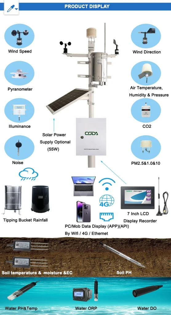
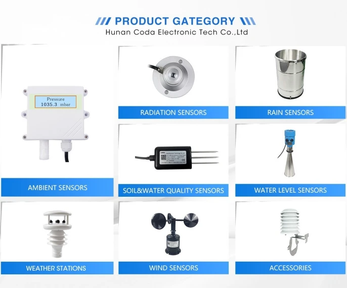
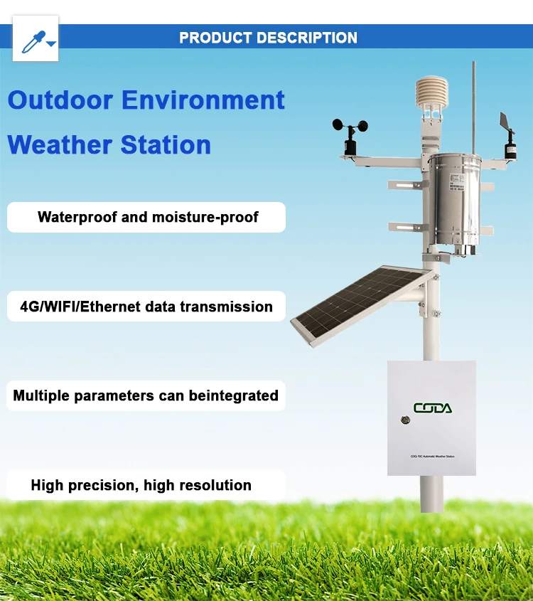
Ground-Level Sensors: Real-Time Local Insights
Ground-level sensors are key for collecting weather data. They give fast and correct local information. Each type of sensor has a special job. They monitor different parts of the atmosphere.
– **Rain Gauges:**
These devices measure how much it rains over time. They help with flood management and planning water resources. Rain gauge data can alert officials in areas that are likely to flood. This helps them take safety measures early.
– **Thermometers:**
Thermometers measure temperature changes. This information is important for climate research and city planning.
Long-term records from thermometers help scientists see climate change patterns. They track things like polar ice melting. Daily temperature data also helps city planners. This data helps them design strong and resilient infrastructures.
– **Anemometers:**
Anemometers measure how fast the wind blows and which way it is going. They help predict storms and other changing weather systems. For farmers, these tools help lower crop damage. They give important information about wind conditions in time.
High-Flying Devices: Weather Balloons and Drones
New tools like weather balloons and drones help gather weather data from the sky. They go beyond what we can do on the ground.
– **Weather Balloons:**
These balloons have radiosondes. They rise several miles into the sky to collect important data on temperature, humidity, and pressure.
During Hurricane Harvey in 2017, balloon data proved to be very useful. It measured how strong the storm was and helped with evacuation plans. This helped officials use resources better.
– **Drones:**
Drones are being used more and more for weather studies. This is especially true in places that do not have regular weather stations. Drones use special tools to gather data on temperature, humidity, wind, and more.
Drones also give real-time visuals during crises like forest fires. They help guide emergency responses. They show how the fire spreads and where to send resources.
Space-Age Technology: Advancements in Satellite Weather Observation
The creation of satellites has changed how we look at weather. They provide a full view of global weather and environmental patterns.
– **Satellite Sensors:**
Modern satellites are great at collecting different types of data. They use different wavelengths to study the Earth’s atmosphere and surface. Infrared sensors pick up heat signals from the ground and the lower atmosphere. This helps to accurately measure temperature and humidity levels.
Microwave sensors can go through thick clouds. They give clear information about cloud shapes and how much moisture is present. Visible and near-infrared sensors take clear images of Earth’s surface and atmosphere.
This information is important for spotting new weather systems. During the 2021 heatwave, satellite data helped predict temperatures. This information helped emergency services get ready for their tasks.
– **Satellite Applications:**
Satellite data is important for long-term weather forecasts. It also helps with real-time decisions during key events. Satellites give us a steady flow of information for long-term forecasts. They help us understand weather trends over months or years.
Real-time satellite monitoring helps weather experts track storms. This includes hurricanes and blizzards, as well as their strength and movement. A good example is how satellite data helped predict the path of Hurricane Harvey in 2017.
This information helped with quick evacuations and improved planning for resources. Satellites do more than just forecast the weather.
They are key to climate research. And they help scientists learn about climate change. They also find ways to lessen its harmful effects.
Specialized Instruments: Addressing Extreme Weather Challenges
Custom equipment is made to collect important data in tough conditions. It ensures accuracy even in severe weather.
– **Mobile Weather Stations:**
These are portable devices. They collect local data on temperature, wind speed, humidity, and rainfall. These tools are very helpful during emergencies, such as severe storms.
During the Texas winter storm in 2021, these stations played a key role. They gave real-time data to help the authorities. This data helped manage water and power. It also focused on the welfare of the community.
– **Hail Interceptors:**
These devices are made to gather hailstones. They help researchers and others understand the risks of hailstorms.
This data helps fields like agriculture and insurance. For example, farmers can use hail interceptors. This allows them to plan better for crop protection.
They can invest in seeds that can resist hail. This will help reduce crop loss.
– **Lightning Detection Systems:**
These systems use sensor networks to find lightning strikes. They give clear information to help predict strike patterns and measure how strong they are. These technologies help protect renewable energy projects.
They help keep solar farms and wind turbines safe from unexpected lightning strikes. One practical use is to turn off wind turbines when there is lightning. This helps lower costly repairs and downtime.
Emerging Technologies: New Innovations in Weather Data Collection
As technologies like Internet of Things (IoT) sensors and artificial intelligence (AI) improve, weather monitoring is changing quickly.
– **IoT Sensors:**
IoT devices are flexible and can be used in many places. They work in busy cities and remote nature areas. These devices give constant updates on important weather factors like temperature, humidity, and air quality.
In agriculture, IoT sensors help with irrigation. They check soil moisture levels in real time. Urban planners use these tools too.
They study local wind patterns and pollution data. This helps them make designs that last.
– **AI Algorithms:**
Artificial intelligence improves the accuracy and speed of weather forecasting. It does this by quickly handling big sets of data. These algorithms help find new events early, such as hurricanes or heatwaves. This helps us respond faster to possible disasters.
AI models can predict where hurricanes will go. They can also find the hottest temperatures during heat waves. This helps officials make cooling or evacuation plans to keep people safe and healthy.
The Link Between Technology and the Environment: Improving Our Knowledge
Using different tools to collect weather data helps us understand climate patterns and events more clearly.
Data Sharing and Collaboration
Working together is important for weather experts, scientists, and those who make decisions. This helps them manage weather better. We link ground sensors to satellite and drone operators.
This helps us collect weather data that is accurate and consistent. Using special tools and weather data gives a clear view of extreme weather events.
This teamwork helps us plan well and react to these events. After a hurricane, data from mobile weather stations can help local emergency teams prepare for storm surges.
Lightning detection systems can help utility companies plan how to respond to outages caused by strikes. Ground-level sensor data, combined with satellite and drone observations, provides a full view of weather events. This helps make better decisions and improve how we respond.
The Evolution of Weather Data Collection
New technology has changed how we collect weather data. This helps us understand and deal with extreme weather events better. Tools like ground sensors, satellites, and high-altitude devices give important real-time information.
New technologies like IoT sensors and artificial intelligence are improving forecasting. This makes it more accurate and efficient in many sectors.
As the world deals with climate change and bad weather, we need quick and accurate data more than ever. Investing in new technologies and improving research are key steps to tackle these challenges.
The future is bright. Drones can help watch over and manage natural disasters. AI can make models that predict extreme weather events better.