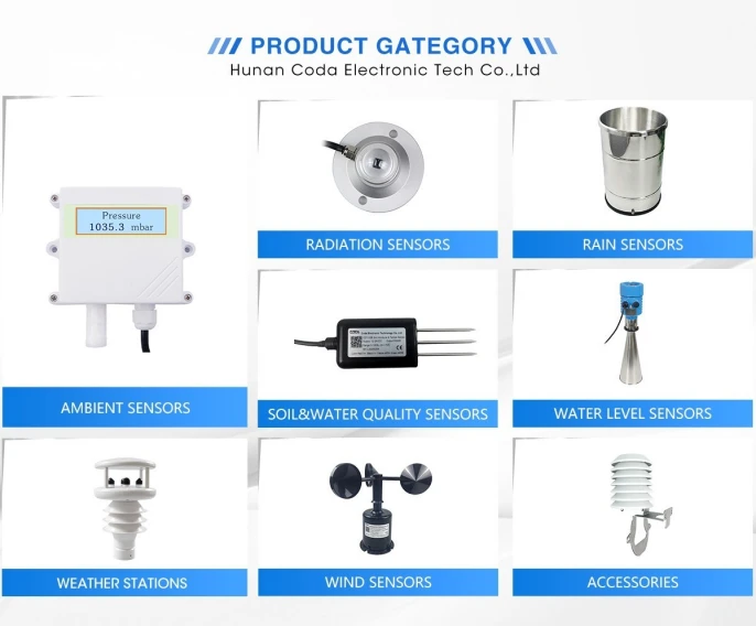
11 Types of Weather Instruments and Their Uses
What are weather instruments?
Weather instruments are specialized tools designed for weather forecasting, monitoring, and other meteorological applications. They are generally divided into two main types: ground-based observation instruments and high-altitude weather detection instruments.
Here’s a rundown of 11 commonly used weather instruments and their applications:
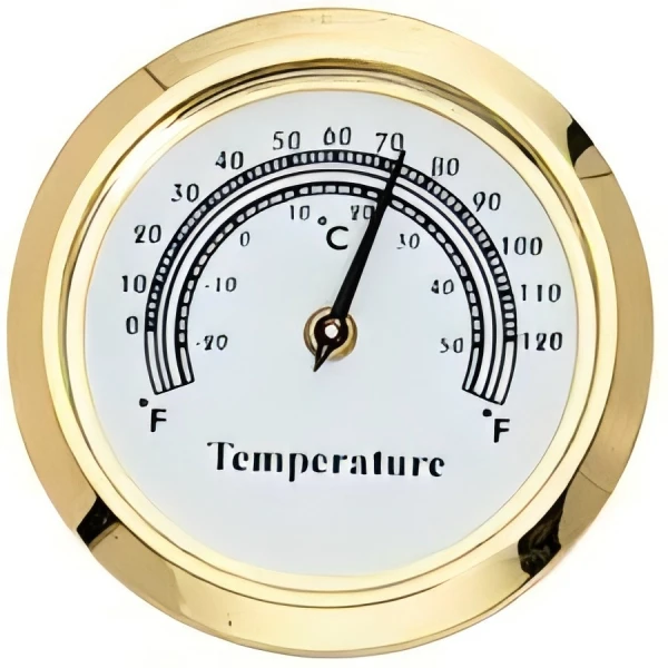
1. **Thermometer**
Temperature is one of the most fundamental factors for weather analysis, making thermometers indispensable in meteorology. They measure and record the current temperature of a given area. Modern advancements have gone beyond traditional liquid thermometers that use alcohol or mercury. Now, we have resistance thermometers, thermocouple thermometers, and semiconductor thermometers. These new types offer higher precision. Today’s weather stations often use platinum resistance thermometers (RTDs) and semiconductor models. Liquid thermometers are usually for older, traditional systems.
Accurate temperature data, obtained via high-quality thermometers, plays a vital role in fields like environmental protection, agricultural meteorology, climate studies, aviation, and navigation.
2. **Barometer**
Atmospheric pressure greatly influences wind patterns, storms, and other weather phenomena. Designers create barometers to measure atmospheric pressure. Traditional barometers often use mercury as a medium, measuring pressure based on the equilibrium of mercury under gravity. Alternatively, liquidless barometers utilize the deformation of a vacuum-sealed metal box to determine pressure levels. Modern weather systems increasingly favor electronic (digital) barometers for improved accuracy and convenience.
Barometric readings are essential for weather forecasting, outdoor activities like hiking, aviation, and maritime navigation.
3. **Hygrometer**
Humidity is another critical meteorological element closely tied to temperature. Hygrometers measure air moisture levels. Older models used human or animal hair to measure humidity. Changes in humidity would change the hair length. Mechanical devices recorded this change. Modern hygrometers can measure changes in the electrical resistance of materials that absorb moisture. This happens when air moisture changes.
Hygrometers aid not only in agricultural irrigation and weather monitoring but also in logistics and storage—preventing mold during transportation or warehousing.
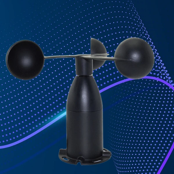
4. **Anemometer**
Anemometers are an essential component of any weather monitoring system, used to measure wind speed. Various types of anemometers exist, suited to different applications. For instance, professional weather stations and home monitoring setups widely favor ultrasonic and three-cup anemometers for their accuracy and reliability.
5. **Wind Vane**
A wind vane usually has an indicator, like an arrow. This indicator attaches to a vertical axis that spins. It points in the direction of the wind. With increasing demand for precision, electronic wind vanes have emerged, employing sensors and rotary encoders to convert wind direction into electrical signals for accurate data collection. People frequently pair wind vanes with anemometers to offer comprehensive readings on wind conditions.
Applications include meteorology, navigation, agriculture (e.g., pesticide dispersion), air quality studies, urban building design, and wind energy generation systems.
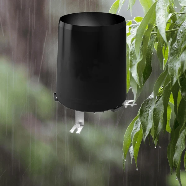
6. **Rain Gauge**
Rain gauges measure rainfall intensity over specific periods in a given area. Basic models feature a funnel and container that require manual readings, while advanced models like tipping bucket rain gauges automatically record precipitation data.
7. Sunshine recorder
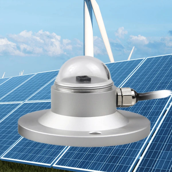
In meteorology, monitoring the sun primarily involves measuring light and radiation. A sunshine recorder is a device specifically designed to capture the duration and intensity of sunlight. Historically, people widely used the Campbell-Stokes Sunshine Recorder, which featured a glass sphere and a recording paper strip. The device operated by burning marks onto the strip based on light intensity and duration. In modern times, digital light recorders based on the photodiode principle have become common in automatic weather stations. These devices detect light intensity, convert it into a weak electrical signal, and ultimately produce an output signal.
In meteorology, sunshine recorders play a vital role in predicting climate changes by tracking sunlight hours. In agriculture, light loggers monitor the intensity of sunlight over farmland, enabling farmers to assess lighting conditions effectively and strategically plan planting and harvesting schedules for crops.
8. Radiometer
Radiometers differ from sunshine recorders and are specifically designed to measure solar radiation intensity. There are various types of radiometers capable of measuring wavelengths ranging from ultraviolet to infrared. Two commonly used types are photoelectric radiometers and thermoelectric radiometers, the latter known for its greater accuracy, albeit at a higher cost.
Radiometers are valuable tools across multiple disciplines: they help monitor solar radiation balance and study the greenhouse effect in meteorology, measure astronomical radiation to understand celestial bodies and the universe’s evolution, and evaluate the environmental impact of pollutants in ecological science.
9. Ceilometer
A ceilometer, also known as a cloud altimeter, measures the height and thickness of clouds using technologies such as laser pulses or photodetectors. Both techniques are adept at capturing low-level cloud cover data.
Ceilometers find applications in fields such as meteorology, aviation, and environmental monitoring. By providing precise cloud-height measurements, these instruments enhance weather forecasting accuracy, improve aviation safety, and contribute to deeper research into climate change and environmental conditions.
10. Radar
Radar is a sophisticated radio wave detection technology that works as an active microwave atmospheric remote sensing instrument. Weather radars operate across a broad range of radio wavelengths—from 1 to 1,000 centimeters—and categorize into bands based on their primary function. People refer to non-Doppler weather radars as non-coherent or conventional radars, while they classify those with Doppler capabilities as coherent or Doppler radars. Weather radars can examine cloud height, thickness, and physical properties to track precipitation distribution, movement, and development.
These systems provide pilots with real-time in-flight weather data along their flight path and surroundings, displaying surface features ahead of the aircraft in a map-like view. This capability allows pilots to select safe routes, avoid hazardous weather conditions or obstructions, identify landmarks, and ascertain the aircraft’s position with precision.
11. Weather satellite
Weather satellites are specialized tools designed to monitor and gather atmospheric and surface data from Earth. Equipped with various meteorological remote sensors, they capture and measure visible light, infrared, and microwave radiation emitted by Earth’s surface and atmosphere. Satellites also record reflected electromagnetic waves from navigation systems, converting them into electrical signals transmitted back to ground stations. Researchers process these signals into detailed maps that show cloud cover, wind speed patterns, and wind direction data.
Weather Satellites:
Weather satellites play a pivotal role in supplying real-time data on various meteorological elements such as cloud cover, precipitation levels, wind speed, and temperature. This information helps mitigate extreme weather events like hurricanes, typhoons, and thunderstorms. Additionally, these satellites are instrumental in monitoring natural disasters such as volcanic eruptions, forest fires, and floods, along with tracking different forms of environmental pollution. They also provide valuable data on soil and vegetation, enabling the development of scientifically informed management programs.
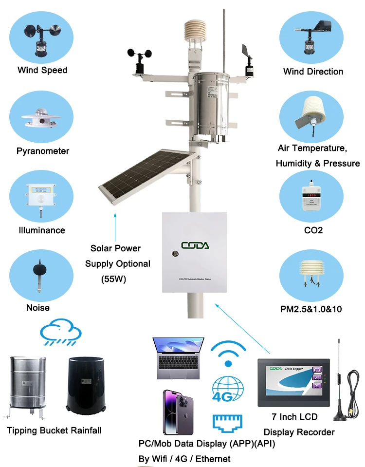
**Relationship Between Weather Instruments and Weather Stations:**
Weather instruments are specialized devices designed to measure and record individual atmospheric variables. These instruments can function independently or integrate into a larger system known as a weather station. A weather station combines multiple weather instruments into a unified setup, facilitating the simultaneous monitoring of various meteorological parameters. In this relationship, weather instruments serve as the foundational components of weather stations, making both aspects interdependent. Together, they offer accurate and comprehensive data for effective weather observation and forecasting.
**Applications of Weather Instruments:**
1. **Weather Forecasting:**
Instruments such as hygrometers, barometers, and anemometers provide real-time atmospheric data that can be processed and studied by control platforms to predict short-term weather changes. Moreover, the aggregation of long-term data contributes to forecasting larger climatic phenomena, including El Niño and global warming.
2. **Disaster Warning:**
Weather instruments enable real-time monitoring of extreme weather shifts. For instance, water level monitoring stations trigger flood warnings upon detecting abnormal water levels. Similarly, satellite systems can track typhoons and hurricanes. This early detection allows authorities to implement response measures promptly, reducing potential losses to life and property.
3. **Environmental Monitoring:**
Instruments like anemometers are used to observe the dispersion and movement of airborne pollutants, including sulfur dioxide, ozone, and particulate matter like PM2.5. This data assists environmental protection agencies in devising efficient strategies to address pollution.
4. **Agricultural Management:**
Weather instruments installed on farms provide real-time data on temperature, precipitation, sunlight levels, and soil conditions. Analytical tools process this data to offer farmers scientific recommendations on optimal crop selection, irrigation methods, and planting schedules. This approach promotes higher crop yields and healthier agricultural practices.
5. **Aviation and Navigation:**
Meteorological monitoring ensures safe aviation and maritime operations. Real-time data from weather satellites is essential for guiding aircraft and ships, helping them avoid hazardous weather conditions during transit.
6. **Urban Planning:**
Data collected by weather instruments aids urban planners in identifying disaster-resilient locations for community development. It also ensures that planners strategically design transportation hubs, such as airports and rail stations, based on climatic factors, which improves safety and functionality.