

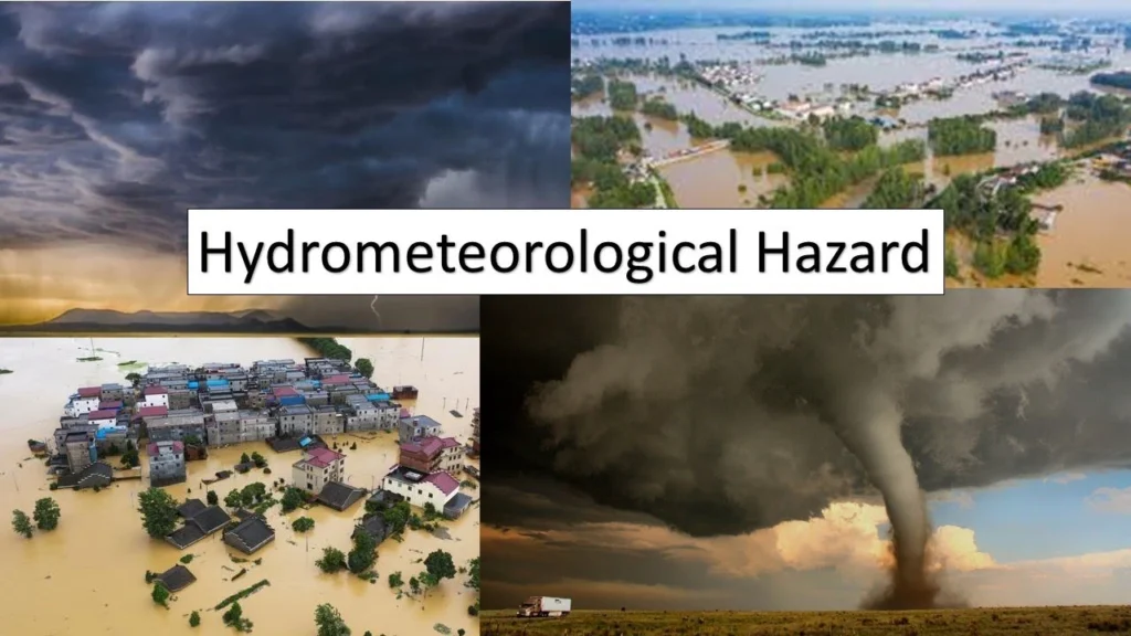
What tools are available for tracking hydrometeorological hazards?
Tools and technologies for tracking hydrometeorological hazards
Many tools and technologies can help track hydrometeorological hazards. These include various sensors, remote sensing systems, models, and information systems. They work from the ground to outer space.
They work together to build a strong monitoring and early warning system. This system aims to reduce the impact of natural hazards on people and the environment. Here is a clear overview of these tools and technologies:

I. Sensors
Sensors form the foundation of monitoring hydrometeorological disasters, enabling the real-time collection of data on essential parameters. Typical sensors encompass:
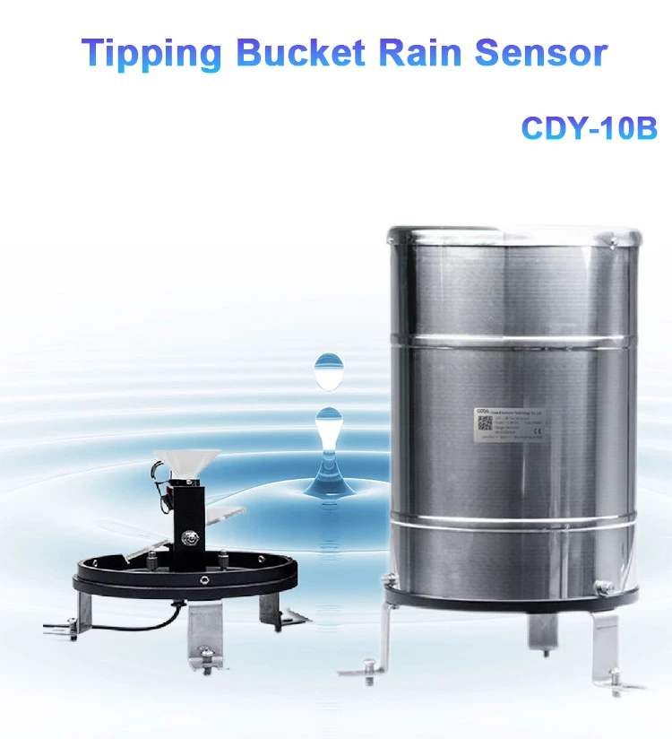
Rain gauges
– Purpose: To measure rain.
– Types: Tipping bucket, siphon, optical, and more.
– Usage: Widely used in weather stations and flood alert systems to provide rainfall information.

water level gauge
– Purpose: To track fluctuations in water levels of rivers, lakes, and reservoirs.
– Types: floating, pressure-based, ultrasonic, radar, and more.
– Uses: Flood alerts help manage water resources. They also look at changes in water levels in water environments.
Water flow velocity measurement device
– Purpose: To assess the speed of water flow.
– Types: ultrasonic speedometer, electromagnetic speedometer, ADCP (Acoustic Doppler Current Profiler), and more.
– Uses: calculating flow, predicting floods, and watching changes in river flow speed.
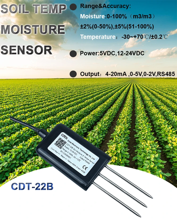
Soil Moisture Sensor
– Purpose: To monitor soil moisture and check how wet the soil is.
– Types: Time Domain Reflectometer (TDR), Frequency Domain Reflectometer (FDR), and more.
Uses include watering crops, predicting floods, and tracking changes in river flow.

Temperature Sensor
– Purpose: Gauging the temperature of both air and water.
– Types: Thermistor, thermocouple, and others.
Uses: Watching the weather, tracking water temperature, and checking changes in air and water temperatures.
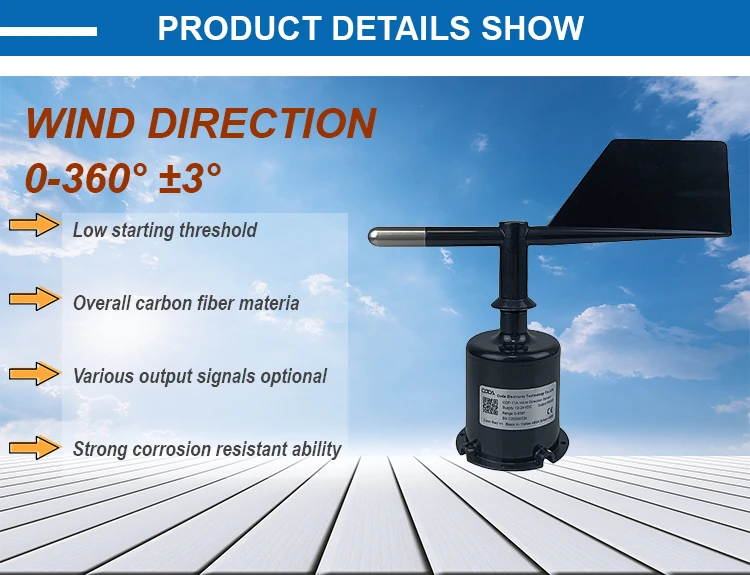
Wind speed and direction sensor
– Purpose: To track wind speed and direction.
– Types: mechanical wind speed and direction sensor, ultrasonic wind speed and direction sensor, and more.
– Uses: predicting the weather, sending storm alerts, and checking wind impact.

2.telemetry systems
Telemetry systems automatically collect sensor data. They send this data to a remote center. They use wireless communication for this. The main parts include:
1. Data Collector
– Purpose: Automatically gathers sensor data and conducts initial processing.
– Features: Works with different sensor interfaces. It can store and send data.
2. Communication devices
– Purpose: Sends data using radio waves, phone networks, satellites, and other methods.
– Types: Radio transmitters, receivers, satellite communication stations, and more.
– Usage: Helps send data from a distance to ensure fast delivery of live monitoring information.
3.satellite remote sensing technology
Satellite remote sensing technology uses sensors on satellites to watch the earth’s surface. This provides a lot of data about the surface. Typical uses include:
Satellite imagery
Purpose: To provide global surface coverage data and track natural disasters such as floods and droughts.
Features: Wide coverage and the ability to capture big weather events. This includes how cloud systems form before typhoons and floods.
Radar satellite
Purpose: To get accurate ground surface data, we need to go through cloud cover. This is important, especially in bad weather.
Features: Works well in any weather, even with clouds. This is great for monitoring in all types of weather.

Doppler radar
Purpose: Watch how rain spreads, its strength, and where it moves. Also, forecast heavy rain and possible flooding.
– Features: Provides quick updates and easily detects changes in rainfall patterns.
Wind field radar
– Purpose: Examines the three-dimensional layout of wind speed and direction in the atmosphere.
– Features: Gives clear details about the wind field, which helps with storm alerts.
Hydrological Models
Hydrological models use math and physical methods to mimic water processes. They aim to predict floods, runoff, and other related events. Common varieties include:
Rainfall-runoff model
Purpose: To model how rainfall turns into runoff and predict flooding events.
Features: Give flood warnings based on past and current monitoring data.
Watershed models
Purpose: Study water processes in a watershed. This helps manage water resources and send disaster alerts.
Features: Provide a complete hydrological analysis by looking at topography, soil, vegetation, and other factors.
Information System (Information Systems)
Designers create information systems to store, manage, and analyze hydrometeorological data and to disseminate early warning information. Common types include:
Hydrometeorological database
Purpose: To store and manage hydrometeorological data, facilitating historical data queries and analysis.
Features: Supports extensive data storage and efficient retrieval, ensuring data integrity and precision.
Geographic Information System (GIS)
Function: Combine spatial data, evaluate disaster risk, and enhance decision-making systems for disaster management.
– Characteristics: Display disaster risks and aid in planning and emergency response efforts.
Early warning system
– Function: Gathers various monitoring data, predicts possible disasters, and sends alerts on time.
– Characteristics: It has ways to share information quickly with decision-makers and the public.
Additional Instruments
1. Unmanned Aerial Vehicles (UAVs)
– Purpose: Used to quickly collect live images and information from disaster sites.
– Features: Very agile, has strong monitoring skills, ideal for emergency operations and assessing post-disaster conditions.
2. Buoys and Drifters
– Purpose: Used to check the quality and flow of water in rivers, lakes, and oceans.
– Features: Float on the water, send data in real-time, great for long observation.
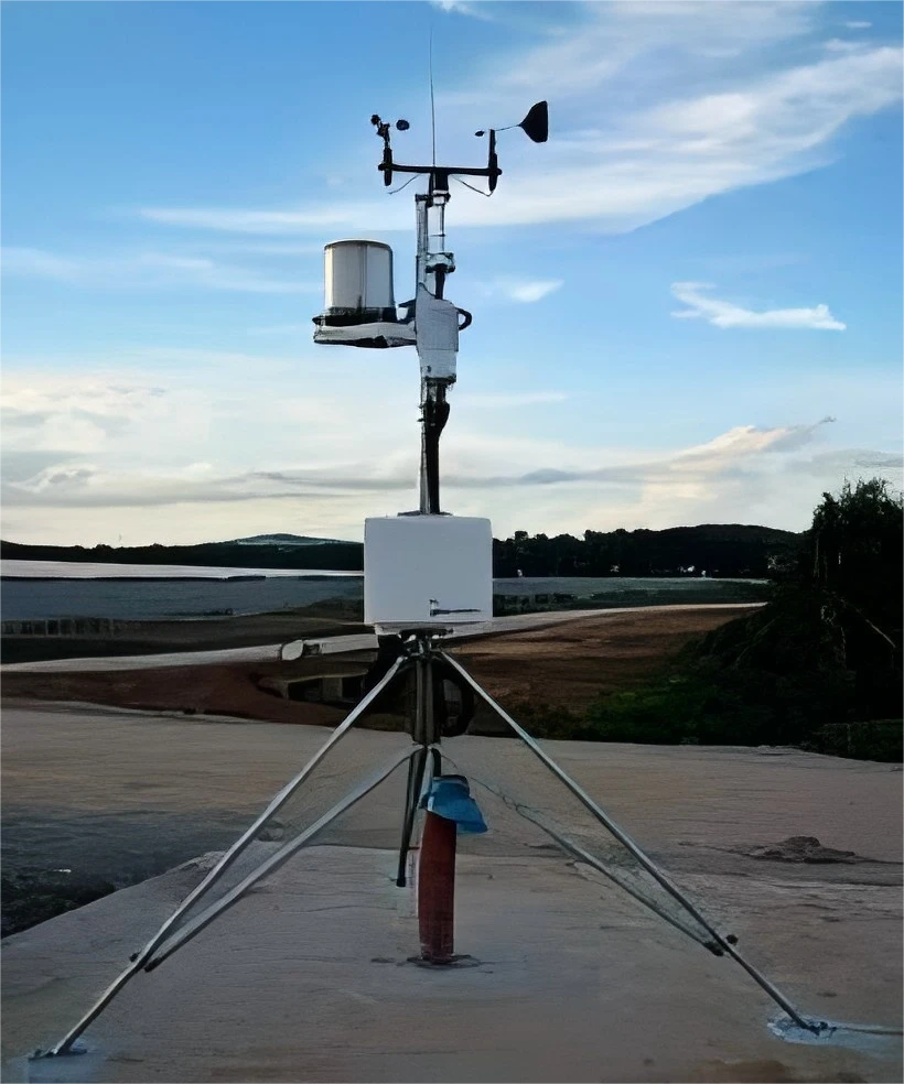
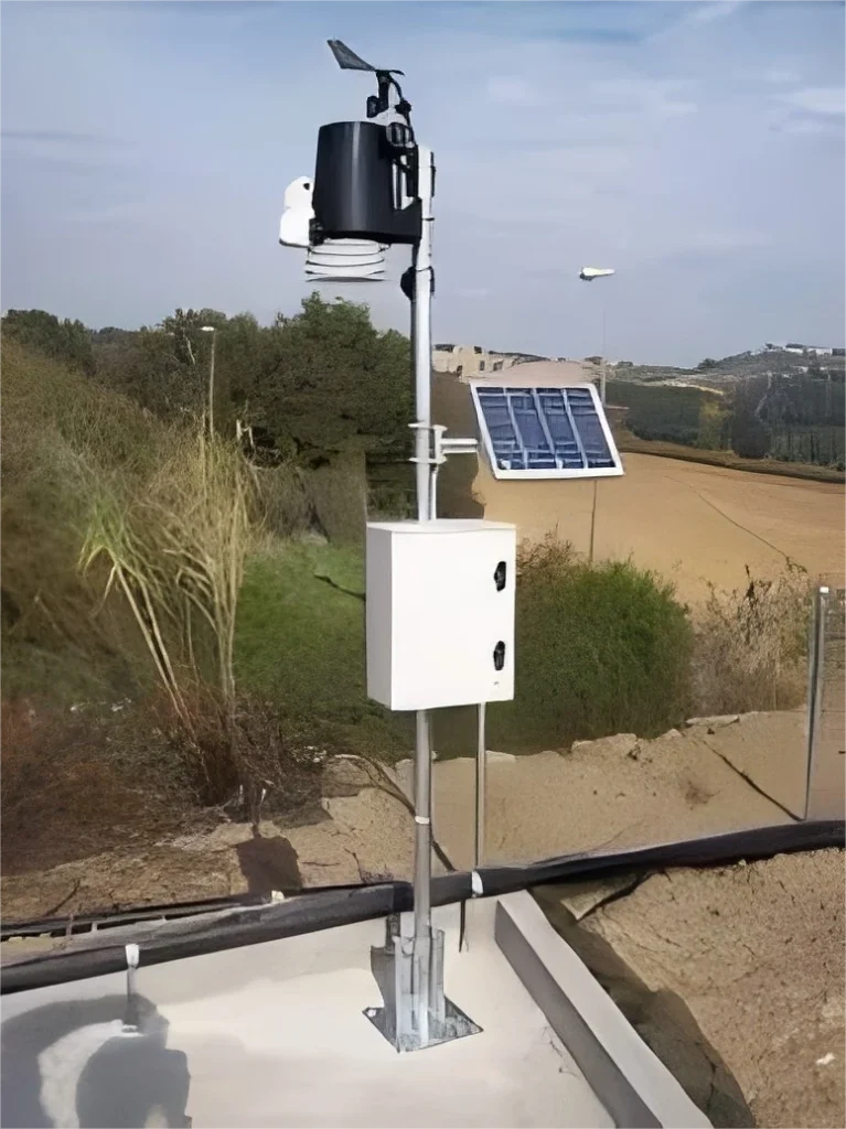
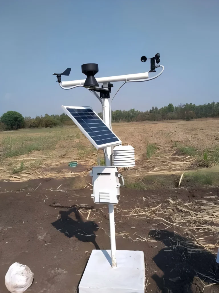
3. Automatic Weather Station (AWS)
– Purpose: It uses different weather sensors to give fast weather information.
– Features: Very automated, accurate data collection, great for weather monitoring in remote areas.

Detailed Application Examples
In real life, we often need to combine these tools and technologies. This helps us monitor and receive early warnings about weather-related threats. For instance, in flood monitoring, the process can be carried out through the following steps:
Data collection: Real-time data is gathered using rain gauges, water level sensors, and stream gauges.
Telemetry systems send data to the control center.
Researchers use hydrological modeling techniques to predict flood trends.
Early warning information flows through the information system. This helps inform authorities and the public. They can then take steps to prevent problems and reduce their impact.
Summarize
The tools and methods for watching hydrometeorological hazards are different. They include many types of sensors, remote sensing systems, models, and information systems. These tools work from the ground to space.
These tools and technologies help us understand and manage water resources. They also help with protecting the environment, public health, and sustainable development. By using these tools and technologies together, we can greatly improve how we respond to weather-related disasters. This helps protect people’s lives and property.